The Vermont Long Trail
- Stitch

- Apr 3, 2018
- 3 min read
Updated: Feb 9, 2021
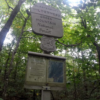
Please go to the Trail webpage for instructions on how to manage any trail obstacles and updates to trail closures and State coronavirus updates. "Vermont’s Long Trail System, with its 272-mile footpath, 166 miles of side trails, and approximately 70 backcountry campsites (many featuring shelters) offers endless hiking opportunities for the day hiker, weekend overnighter, and extended backpacker. The Long Trail follows the main ridge of the Green Mountains from the Massachusetts-Vermont state line to the Canadian border, crossing Vermont’s highest peaks." -green mountain club Vermont’s Long Trail https://www.greenmountainclub.org/the-long-trail/ I started hiking this trail South Bound from the Vermont-Canada Border in 2017.
it was my first time backpacking. i took my time, shelter to shelter. After 15 miles with a heavy pack, the wrong shoes, and way to much food, in some of the most difficult terrain (and a hurricane in the way) i decided to return home.
I planned on going back to Jay Camp and continuing south in 2018. However I began my North Bound (NOBO) hike from the Massachusetts border north Ending at Stratton mountain. with 40 miles behind me in half the time of my first hike I felt pretty good. I went back the following year.
2019 from stratton to route 4. eating wild apples and rasberries, up and over Killington (i blue blazed up to the top first! what a view! ) hopped on the free bus at rt 4 and of course i went to the yellow deli in Rutland and stayed there a few days. (work for stay, or donation based hostel.
free laundry, loaner clothes, and breakfast- covid may affect that- check first)
nearby see thundering brook falls along the Appalachian trail east of where the Long Trail splits and continues north.

RESOURCES:
New food storage rules for 2019! The Green Mountain National Forest, which includes a Long Trail / Appalachian Trail shelter where a bear had to be euthanized, is now requiring all food to be stored in bear-resistant containers or suspended from a tree 12 feet from the ground and at least six feet from the tree.
The order, announced Wednesday, July 24, and also requires hikers to carry out all food trash as of September 2019 URSACKS are acceptable.
check with the green mountain club before you hike for the most current updates
also refer to the green mountain and finger lakes national forest service page HERE.
The Vermont Long trail is one of the best supported trails through the tireless efforts of the Green Mountain Club. https://www.greenmountainclub.org
paper maps and guides https://store.greenmountainclub.org/
in my opinion the best app to have on your Phone for this trail is the Guthook Guide by ATLAS GUIDES
it saved me when I lost my map, and is up to date on information like water sources etc.
you do not have to be connected to the internet to use this app. don't ever rely on an electronic guide as your sole source of information in the event it fails, always have a paper map and compass with you.
find the guide for Android or iPhone here
https://atlasguides.com/long-trail/
Long Trail Shelters https://www.downthetrail.com/hiking-the-long-trail-vermont/shelters/
Thundering Brook Falls the 6th longest in the state
US forest service info
for the falls
Google map
to the falls
Thundering Brook Falls Trail
on the falls
from only in your state
Long Trail facebook page
they also have a
side to side hike
another hiker suggested resource
Resupply ideas
Fun Fact
The Long Trail in Vermont was the inspiration for the Appalachian trail
- Green Mountain Club


Comments